Skip to content

Engineering

Turning property data into solar insight.

Understanding whether a roof suits solar used to need a site visit, a tape measure and years of experience. We build the engineering that lets it start from data instead: imagery, elevation, weather and software working together.

Our approach

AI-first. Problem-solver first.

We start from the problem, then use AI, data and physics to remove the manual work entirely, not just speed it up.

  • AI-first, not AI-added

    We don't bolt AI onto a manual tool. Automation is the starting point: computer vision and machine learning do the measuring, so people can focus on decisions.

  • Problem-solver first

    We start from the real problem, like a shared roof on a terraced street or a tree that shades half a roof in winter, and work back to the technology that solves it.

  • Grounded in science

    Our AI is anchored in physics, geometry and real data. Every model is measured against reality before we trust it.

  • Built for scale

    What once took a site visit and an afternoon should take moments, for every home, not just the easy ones.

Our disciplines

Six areas of deep expertise.

Each discipline owns part of the problem, but none works alone. A vision model is only as good as its imagery, and an API is only as useful as the testing behind it.

Geospatial engineering

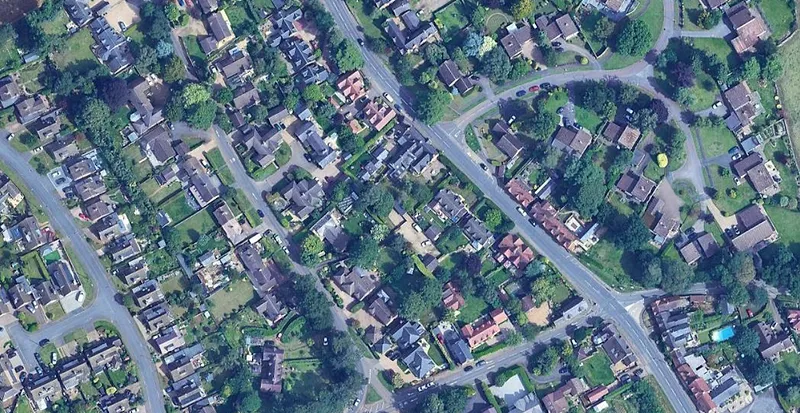
We turn a location into a precise, measurable picture of a property by combining aerial imagery, elevation data and building outlines.

The challenge: Property data arrives from many providers, in different formats, resolutions and capture dates. Before anything can be measured, it has to be aligned, matched to the right building and checked for gaps.

What we work on

  • Matching a location to the right building, including shared roofs
  • Aligning imagery, elevation surfaces and building footprints
  • Mapping data coverage and quality across regions
  • Spatial data processing at scale
Aerial view of a suburban street grid in England
Aerial imagery © Google

Computer vision & machine learning

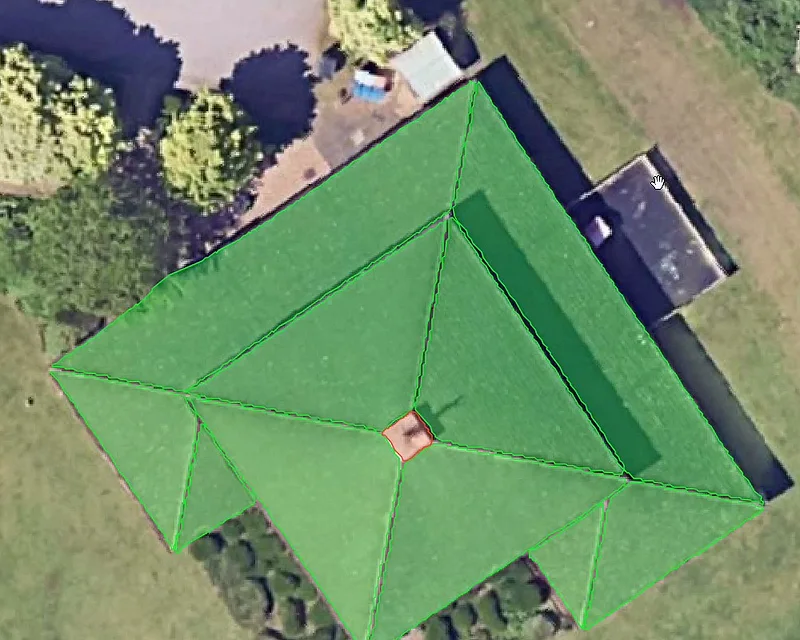
Our models read roofs from above, finding each roof face, its edges and anything in the way, such as chimneys, dormers and skylights.

The challenge: Roofs are varied, cluttered and often partly hidden by trees or shadow. Models have to cope with imperfect imagery, and we need to understand exactly where they succeed and where they fail.

What we work on

  • Roof and obstruction detection from aerial imagery
  • Combining imagery with elevation data for more robust results
  • Building and labelling high-quality training data
  • Rigorous model evaluation across many types of homes
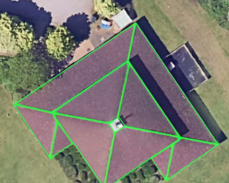
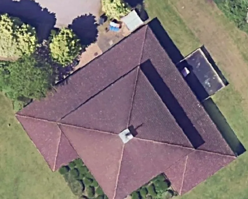
A pyramid roof detected and highlighted in green by the roof model
Roof detection in the Your Power calculator

Roof geometry & solar modelling

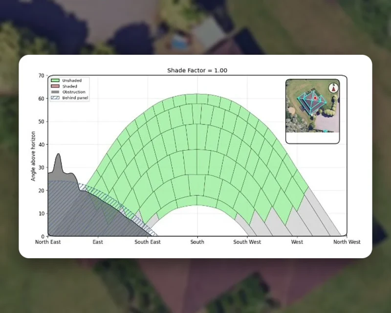
We model how sunlight and shade move across a roof through the year, and what a solar system there could realistically generate.

The challenge: Two roofs of the same size can perform very differently. Pitch, direction, nearby trees and neighbouring buildings all change what a system will really produce.

What we work on

  • Roof pitch and direction from elevation data
  • Sun position and shading simulation through the year
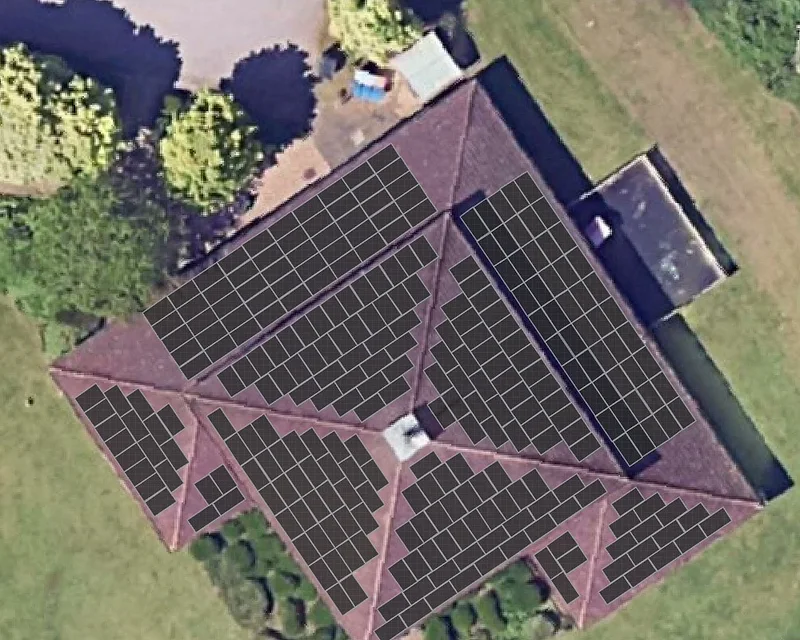
  • Panel layout within real-world constraints
  • Energy generation estimates from weather data
Sun-path shading diagram for one roof face, shade factor 1.00
Sun-path shading analysis in the Your Power calculator

Backend & API engineering

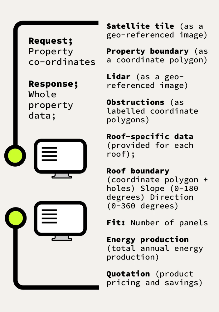
We build the services that run complex analysis on demand and deliver results that other software can depend on.

The challenge: A single analysis touches several data sources and compute-heavy steps. Delivering it through an API means being fast, predictable under load and never breaking the integrations built on top.

What we work on

  • API design, versioning and documentation
  • Reliable orchestration of multi-step analysis
  • Caching, retries and graceful handling of missing data
  • Monitoring, performance and observability
Your Power API: request property co-ordinates, response with whole-property data
The API's request and response, as published by Your Power

Cloud & data infrastructure

We store, move and process large imagery and elevation datasets securely, efficiently and at scale.

The challenge: Geospatial datasets are large and expensive to fetch and process. Pipelines must be reproducible, secure and cost-efficient, with clear rules on where data lives and for how long.

What we work on

  • Data pipelines for ingesting and preparing spatial data
  • Cloud storage, lifecycle and retention policies
  • Infrastructure as code
  • Security and cost control
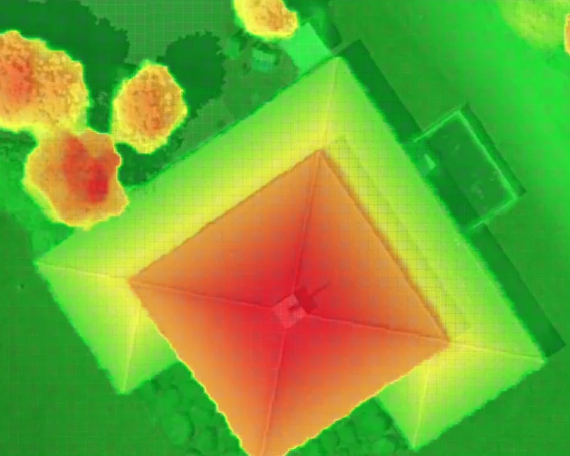
A digital surface model of a roof and its surroundings, coloured by height
Elevation data, processed for every property analysed

Quality engineering

We test the answers, not just the code, from automated tests to careful review of real analysis results.

The challenge: In geospatial software a result can look perfectly valid and still be wrong. Quality here means validating geometry, catching data gaps and building review loops that make the system better over time.

What we work on

  • Automated testing across services and pipelines
  • Reference datasets that catch regressions
  • Human review of difficult and unusual cases
  • Release checks and quality monitoring
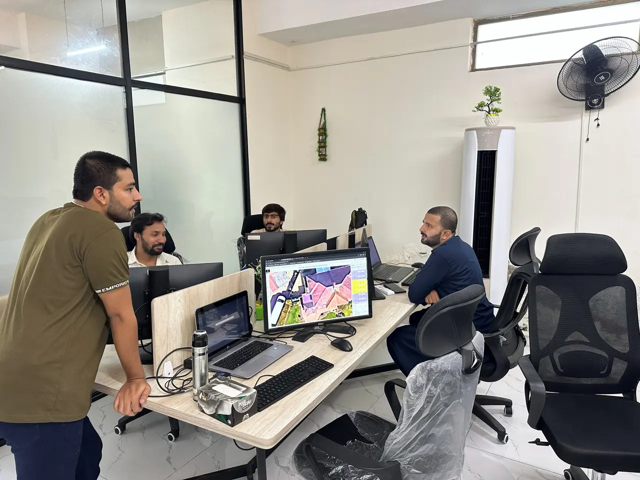
Engineers in Lahore reviewing a solar roof layout on a large monitor
Reviewing real roof layouts before changes ship

In the product

Real analysis, layer by layer.

The disciplines above come together in Your Power's calculator. Switch layers to see what each stage produces for one real property.

Aerial (RGB) layer from the Your Power calculatorReal screens · Your Power calculator

Map layers

One roof, seen three ways.

The starting point: one property, resolved from an address to its plot and roof.

A closer look

How a computer reads a roof.

Two simplified examples of the techniques involved.

aerial imageper-pixel classesplane polygons
From aerial image to roof-plane polygons. Simplified illustration.Segmentation
pitch θobstructiondistance along profile →height (z)
A cross-section through a digital surface model (DSM). Noisy height samples are fitted to planes to estimate pitch.DSM & elevation

How we work

Engineering principles.

  • Measure, don't assume

    We test our work against real-world data before we trust it, and let the evidence decide.

  • Be honest about uncertainty

    When data is missing or unclear, our systems say so rather than hiding it behind a confident number.

  • Design for the hard cases

    Terraced houses, trees, dormers and complex roofs are exactly where we spend our time.

  • Ship often, learn fast

    Small, frequent releases with clear measurements beat big launches and guesswork.

Want to work on this?

These problems are still open. Come and help us solve them.